
Day Trip: Hatch Valley and Old Mesilla
by Bruce • August 27, 2020 • Roadies • 2 Comments
This last Saturday, I had the need to get out of the house for a while, and with it being near the end of August (and, with my small chile crop faltering late in the growing season), a destination for a day trip became clear.
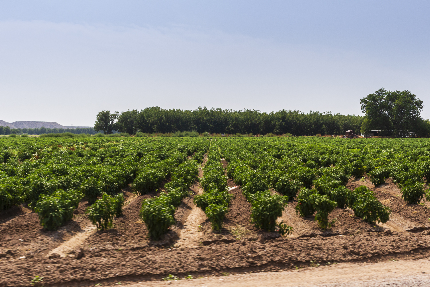
Despite being a native New Mexican, I had never visited Hatch, New Mexico, the “Chile Capital of the World”, and with farms in Hatch Valley presently in harvest mode, it made sense that I head south- because my sister and I were going to need to buy chile in bulk for the winter anyways.
On Friday night, I visited a few web sites, a state map, and some guide books to think about a good itinerary for the following day. I would be in Hatch for some of it, no doubt, but what else would I like to see while in the area?
The following morning, a sort-of plan in hand, I was on the road by 5:20, headed south for that sacred valley of chile peppers.
Old Mesilla
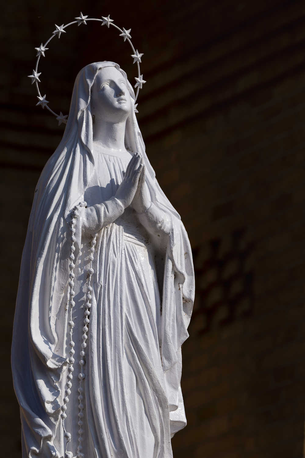
Statue of the Virgin Mary, Basilica of San Albino
I left before dark because I wanted to start my day 35 miles southeast of Hatch, visiting the historic plaza at Mesilla in south Las Cruces.
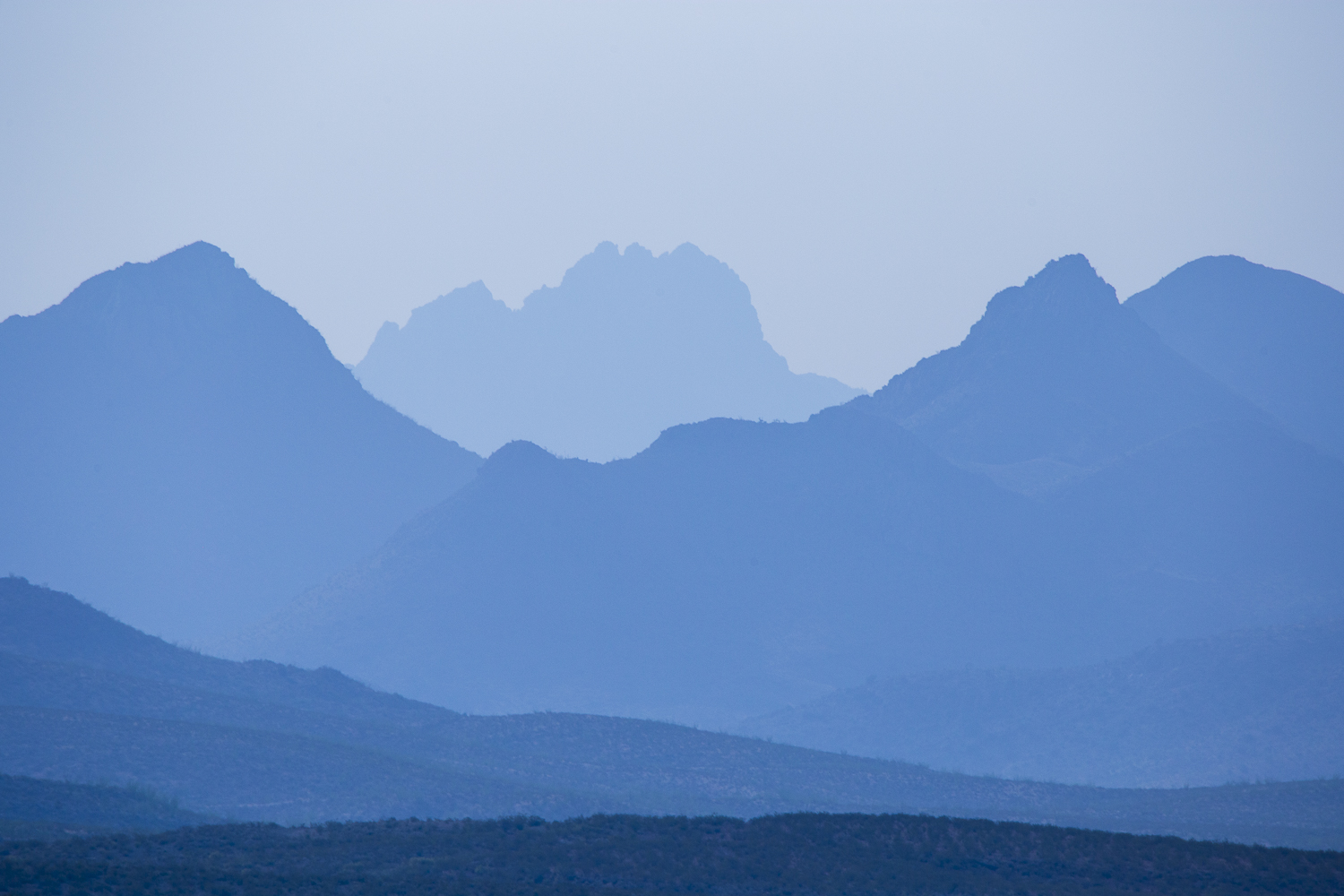
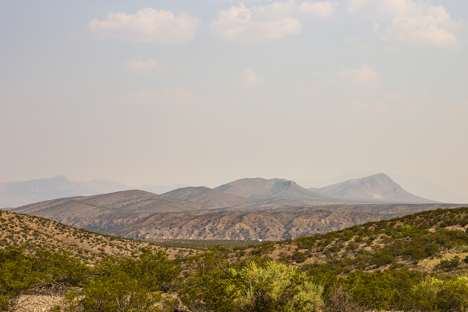
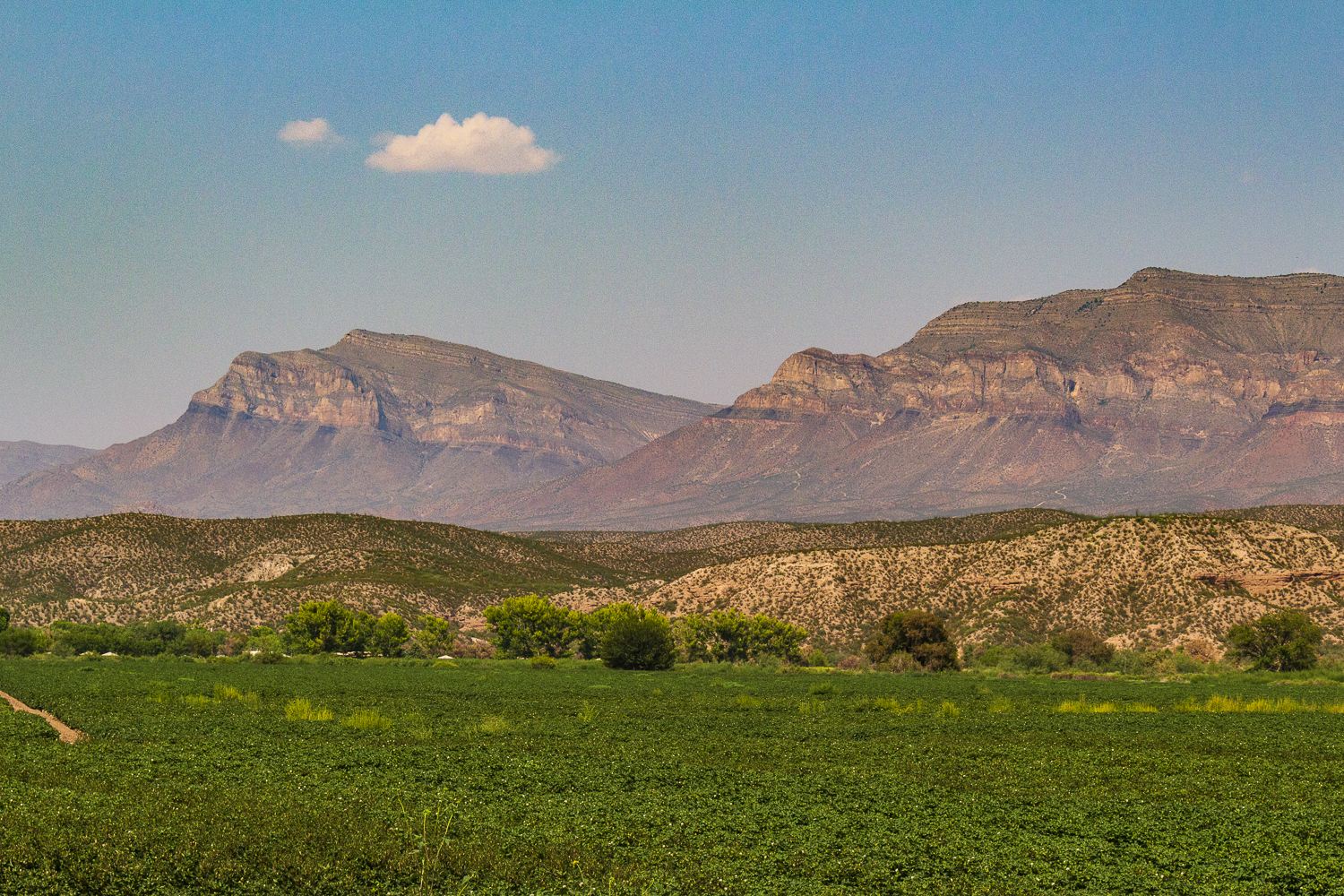
I sped south on I-25 and enjoyed watching a red sun rise as I entered Socorro and stopped for gas. The red sun was a product of regional forest fire smoke in New Mexico’s skies, and as the new day stretched out over the landscape, a haze cloaked distant mounds and mesas in softened silhouettes. By the time I entered the Las Cruces city limits, the morning skies had become muted grays and browns, and the Organ Mountains, which I had looked forward to witnessing in person, were simply a gray blob with jagged peaks that grabbed at the drab sky.
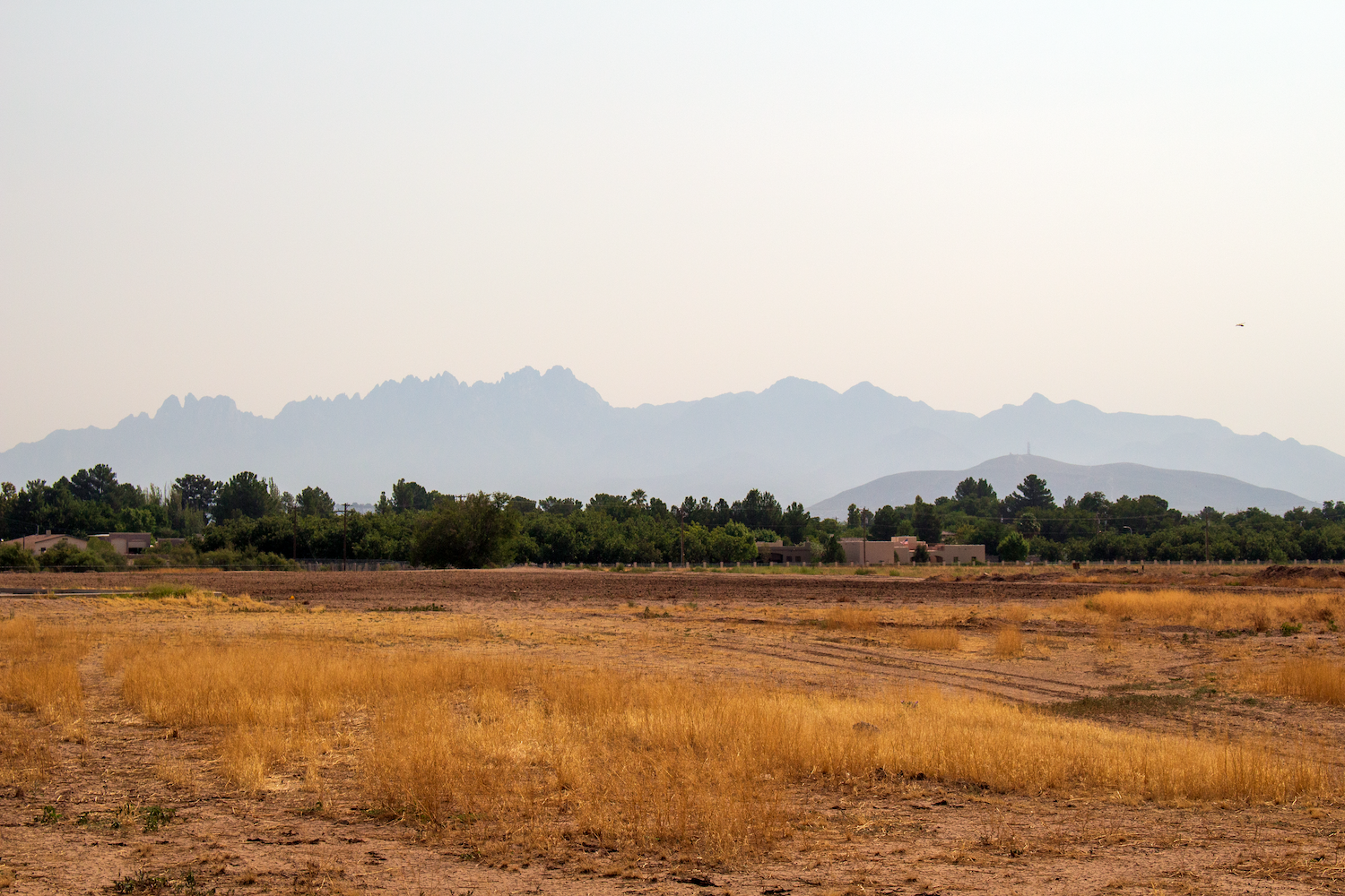
Silhouette of the Organ Mountains
Mesilla was, at one time, a prestigious village that had burgeoned before the emergence of Las Cruces, before railroads came to New Mexico.
Mesilla was settled in 1848, when the Treaty of Guadalupe Hidalgo moved the southern border of the United States south of the town of Dona Ana, and a number of people in Dona Ana didn’t want to be in the United States. Mesilla was established by these Dona Ana refugees. To their dismay, Mesilla became a U.S. territory within 5 years anyways, with the Gadsden Purchase of 1953.
From 1861 to 1962, Mesilla was the capital of the Confederate Territory of Arizona, until the area was captured by Union troops.
Mesilla was the dominant community of the region, host to two stagecoach lines and a range of Wild West personalities up until the 1880’s, when the Santa Fe Railway chose to build a line through Las Cruces instead of expensive Mesilla, sending the village into decline. Eventually, Las Cruces grew up and around Mesilla, but the village was preserved as a township.
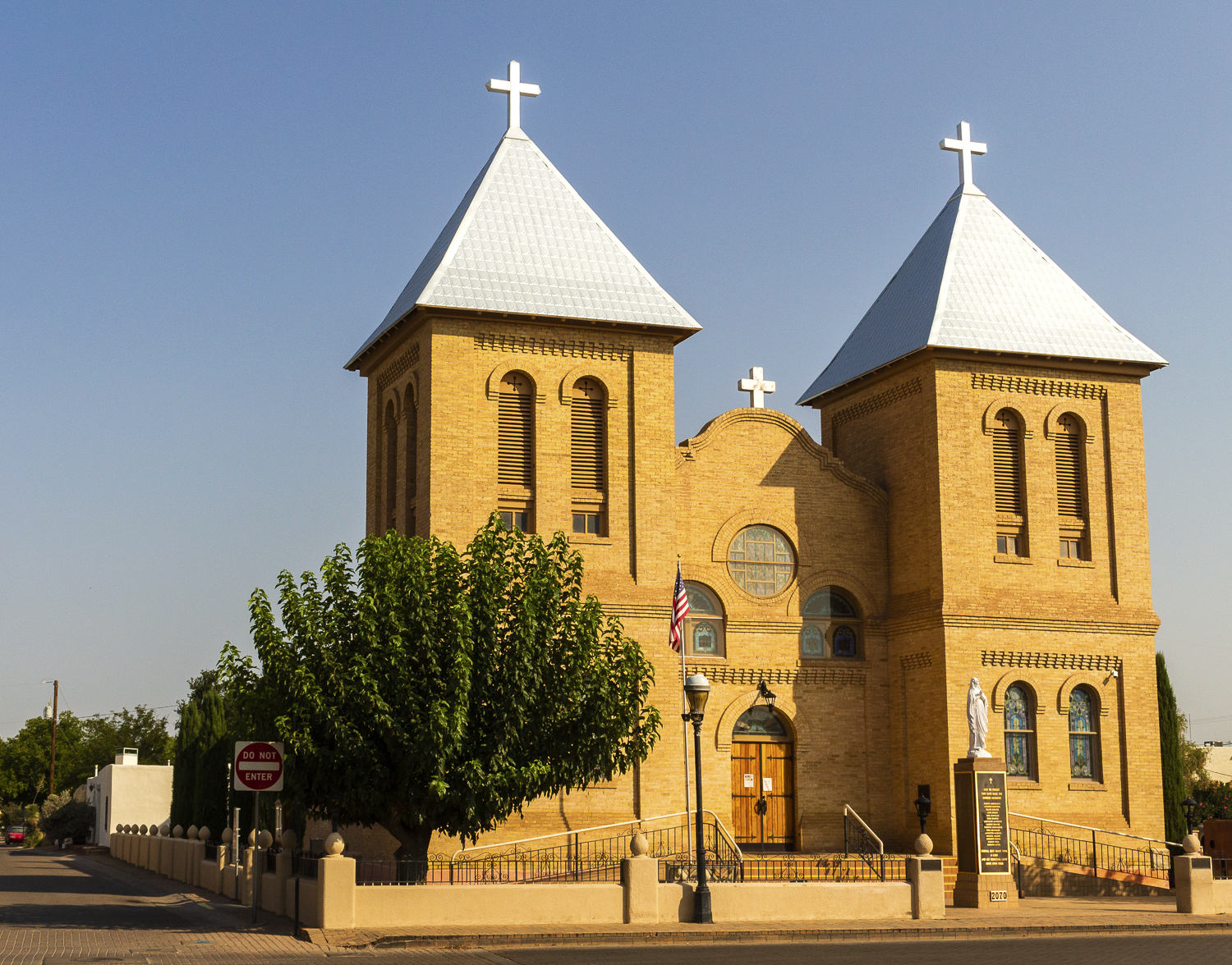
The Basilica of San Albino
What I wanted to see, though, was the town’s historic plaza, which is home of the Basilica of San Albino, and which was made a national landmark as part of the La Mesilla Historic District in 1961.
I arrived at the plaza around 8:40 AM, and in the quiet of the morning, enjoyed taking in the exterior of the church and the elements of the plaza, with its central gazebo. A band of firemen did calisthenics near the gazebo before departing on a morning run. Several masked locals walked their dogs on the plaza streets. Another man photographed the church. Tourists arrived seeking sites and food at nearby restaurants.
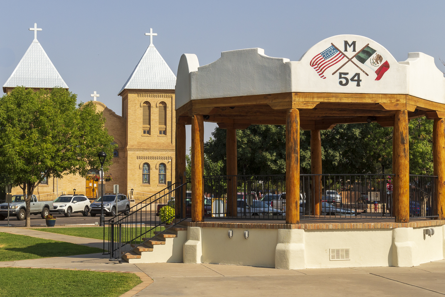
Church and Gazebo, Mesilla Plaza
I am glad I stopped to see the square, but I was a bit surprised and underwhelmed by it, as I am familiar with the plazas in Albuquerque and Santa Fe. This one was, while famous, was much smaller. The Basilica, while pretty, was also a smaller structure than I anticipated. But it was an intimate plaza, and I was glad to see it first hand.
Dona Ana
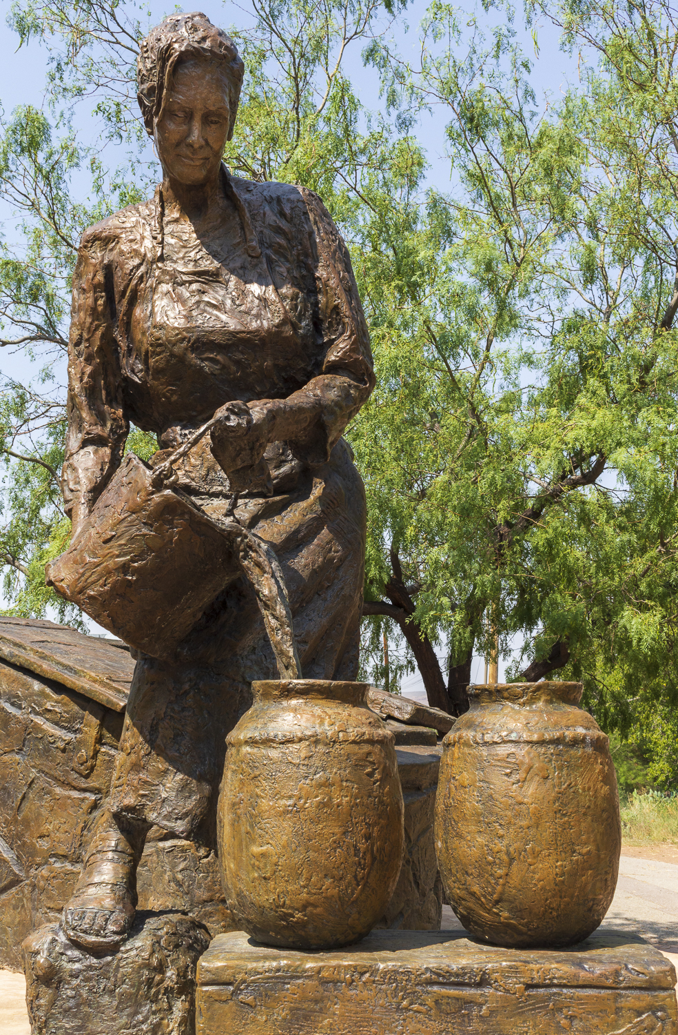
Statue of Dona Ana
With the morning warming up, I left Mesilla Plaza and drove out from a complex of non-descript square stores and warehouses in south Las Cruces and back onto I-25, and then I exited 10 miles up the highway onto rural roads that boxed in green fields of ground plants and rows of pecan trees. My goal was to satisfy my interest in old and holy places, and within the checkerboard of these farms and fields, I sought the Dona Ana Historical District, which featured an old church.
My smart phone finally led me to my destination- which quickly introduced itself as a thin, single block of adobe interests within a neighborhood of concrete and plaster houses with chain-linked fences and cluttered dirt yards. A large gravel lot sat empty across the road from a white plastered church. On up the lane, a line of adjoined adobe structures lined one side of the road, a historical district of ambiguous relevance.
And yet, these buildings and this road where living remnants of the El Camino Real- the royal road extending from Mexico City to Santa Fe which the Spanish used and protected for three centuries.
As a place, Dona Ana is mentioned in Spanish documents dating back to the middle 17th century, and the settlement was named after a legendarily kind and charitable woman who had lived in the farming community during those days.
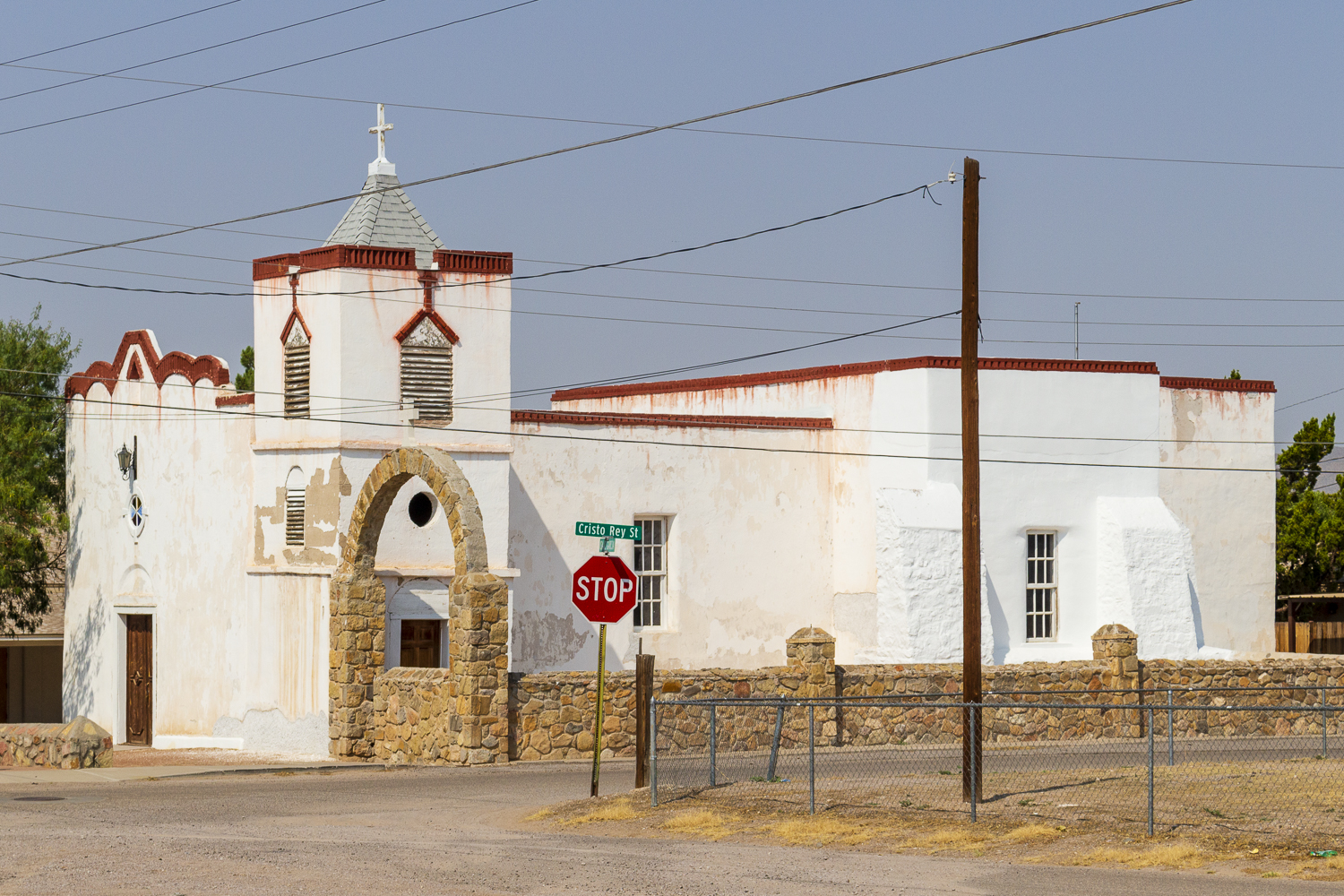
My quest in Dona Ana ended at this church yard though.
Built in 1844, Our Lady of Purification Catholic Church is recognized as the oldest example of an “adobe vernacular” church in southern New Mexico, which means it was built by locals using local resources, without the specific guidance of an architect. It is a unique building, and I would have enjoyed seeing inside of it. The door to the bell tower adjoining the church was open, so I enjoyed a glance at the crude stairwell which let the bell ringer ascend the tower to pull the cords that alerted locals to church events. The church is cruciform in shape, simple, and unique in this farming community.
By the time my visit at the church was done, I was ready to continue north to find the restaurant in Hatch many had recommended I visit.
Hatch
A chorus of respondents on social media said that the place to visit first for food in Hatch was Sparky’s Burgers, BBQ, and Espresso (a.k.a. Sparky’s), so to Sparky’s I went.
It was recommended that I get there before 11 or after 2 to get a meal because the place always has a long line of hungry visitors at meal time- and that recommendation was correct. My 11:40 arrival put me at the back of a long line of folks waiting to order from this novel eatery.
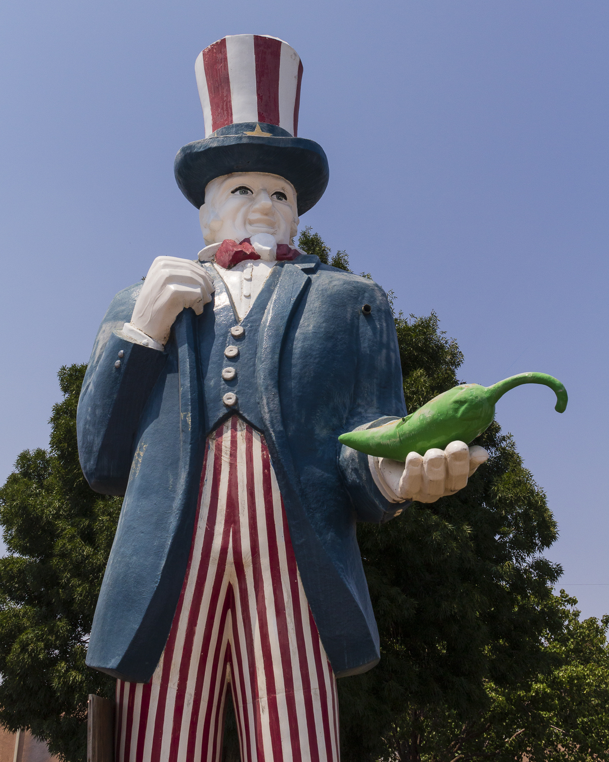
Unable to enter the building, when we arrived at the fromt of the outdoor line, our orders were taken and fulfilled through two windows. Still, you knew you were at the right place to eat at because Sparky’s owns the main corner of Hatch with its sprawling presence, its congregation of customers, and its collection of giant fiberglass figurines (mostly acquired from other restaurants) scattered by the intersection.
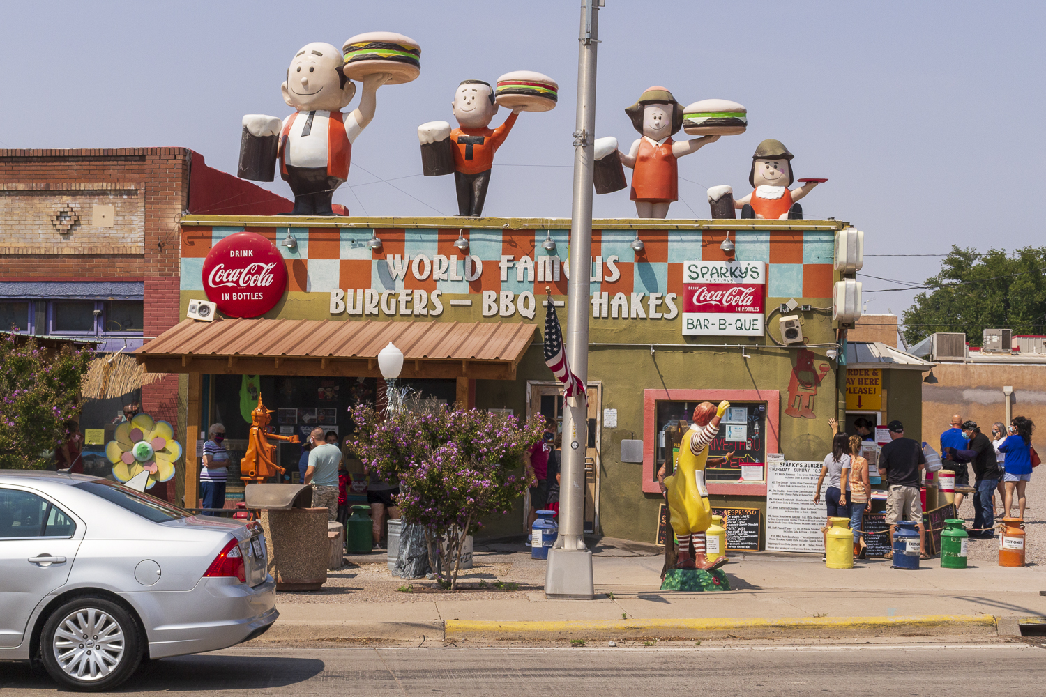
Sparky’s, the food funhouse of Hatch.
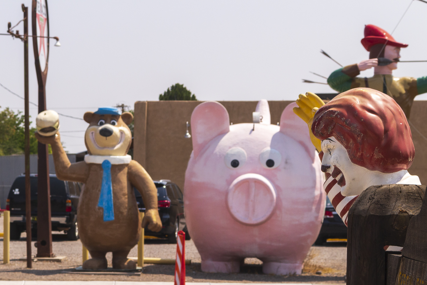
At Sparky’s, you’re always warmly welcomed by a fine assembly of retired greeters.
My 35-minute wait to order my lunch was satisfied when my name was called and I received my fare: a #1 World Famous (a 7 oz. green chile cheeseburger) with cole slaw (which, new to me- and worked, included some small pineapple wedges as an ingredient) and a strawberry shake. The burger was moist and the buns were warm but solid, and the chile was, well, Hatch chile. I wolfed down the meal sitting in the cab of my truck in the shade of a closed bank building, its lot an annex to Sparky’s parking sprawl around the restaurant. I was glad I had also asked for a tall cup of ice water with my meal. With temperatures pushing 100 at midday, I was sweating from just standing in line in the shade to buy the food. All told, Sparky’s provided me with a fine meal.
After lunch, the works part of my day began- selecting a chile vendor, and purchasing some chiles to take home.
Exiting I-25 west to enter Hatch, you discover there are numerous markets on both sides of North Franklin Street to choose from, and on this Saturday afternoon, each was moderately busy. I opted to take a tip I had received from a friend and headed on into town on Franklin- nearer to Sparky’s- to the Grajeda Hatch Chile Market. With a good stock of produce and chile-related items and gifts that were competitively priced, I wanted to skip shopping around and just buy from this store.
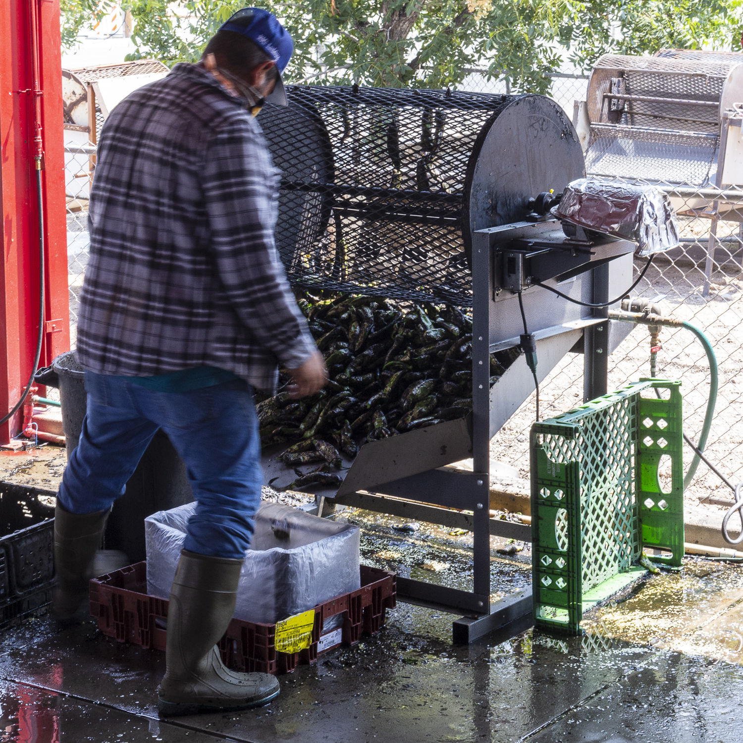
A finished batch of chiles is emptied from a turning roaster.
My mission demanded that I buy a burlap sack of medium, and a burlap sack of hot green chile, and let the market guys roast it. I added several red chile ristras to the order as requested. The chile purchased, I then joined the group amassed under the awning of the market’s large porch where five turning chile roasters were roasting customer purchases. It sure smelled delicious.
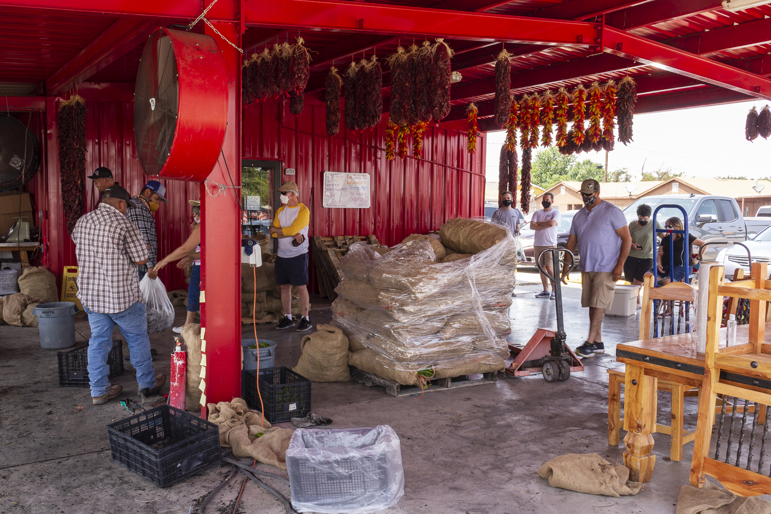
Employees help customers on the patio roasting floor in front of Grajeda Hatch Chile Market.
When my chiles were roasted, the plastic bag containing each batch went into a giant plastic storage bin partially filled with ice, which went into my truck bed. My hope was the ice was enough to keep the peppers moderately cool on our drive back to Albuquerque. (Narrator: They did not.)
Rodey
My shopping done and chiles stowed, I had it in mind to head south again to visit Radium Springs, home of Fort Selden and at one time, its regiments of Buffalo Soldiers. but halfway there, a glance at my phone clock told me my idea was a poor one, and my compromise was to get off of I-25 and to drive through some of the farmland south of Hatch, which ended up leading me to see a church tower, and pulling me into the colony of Rodey.
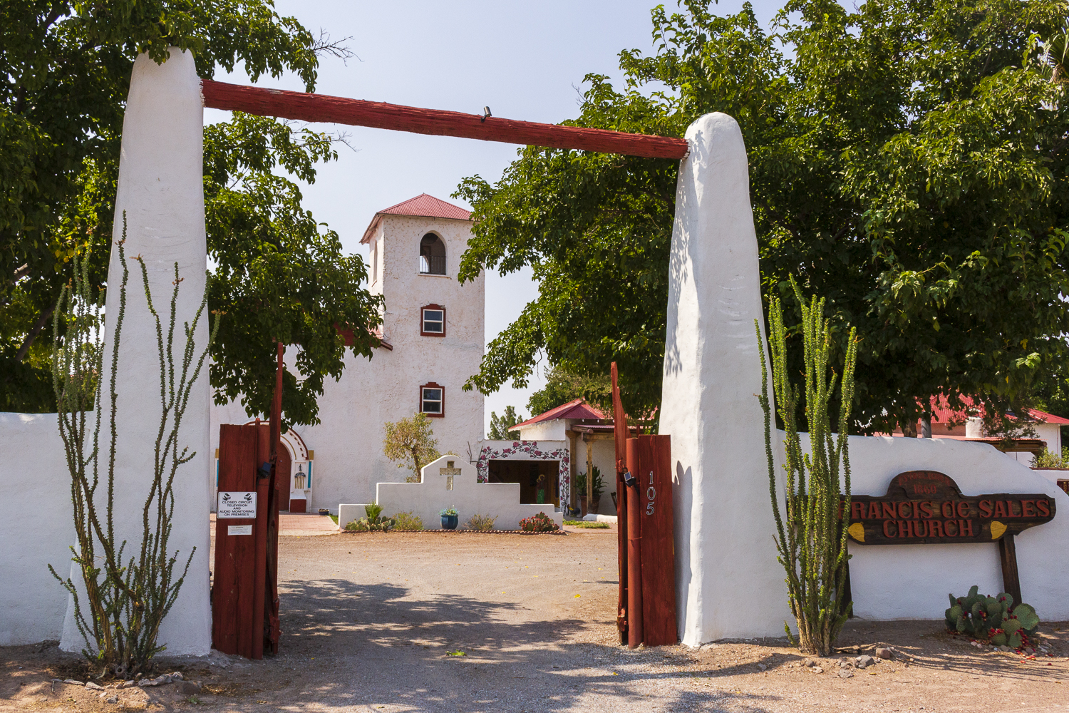
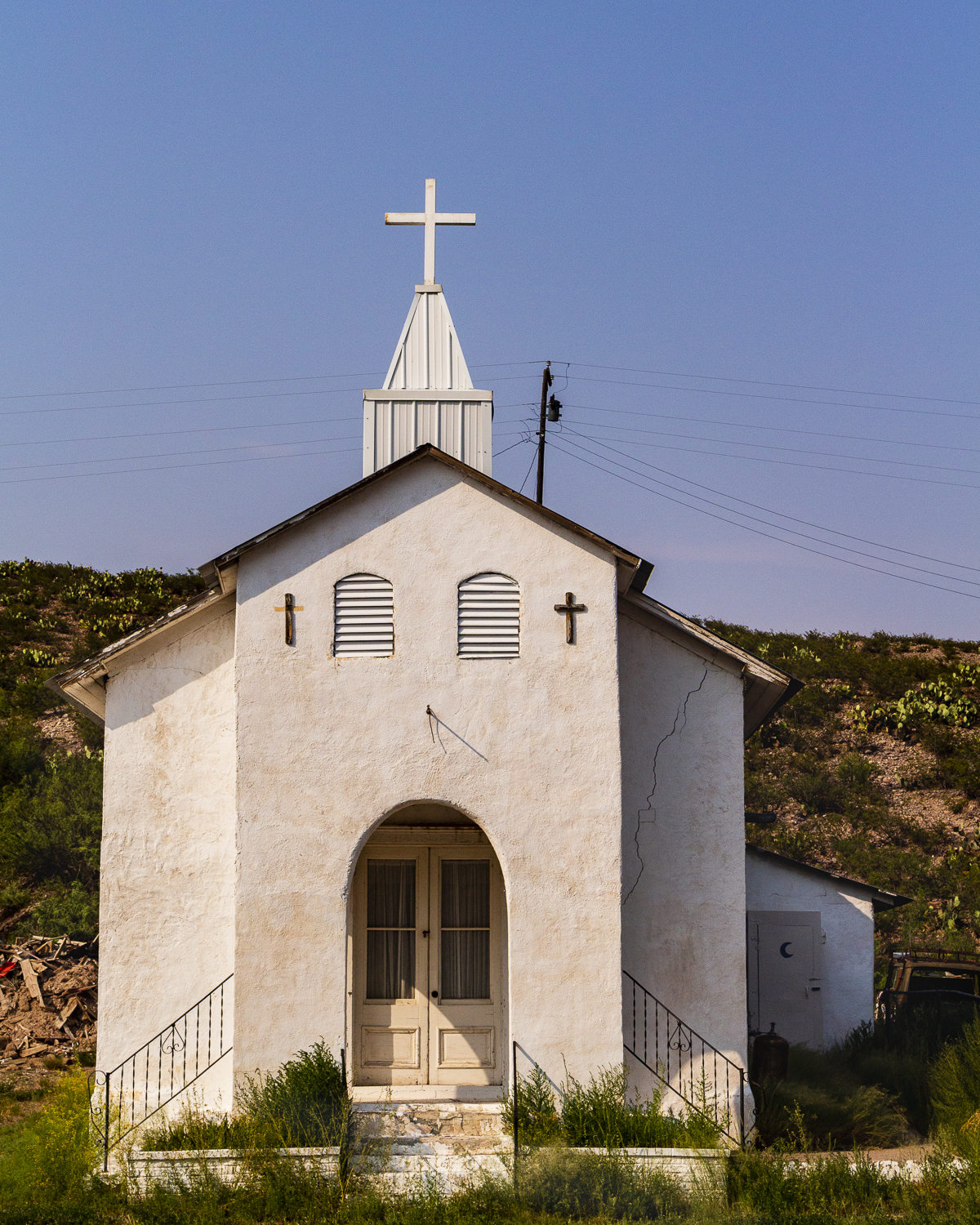
Celeste’s Church, formerly St. Francis de Sales Church.
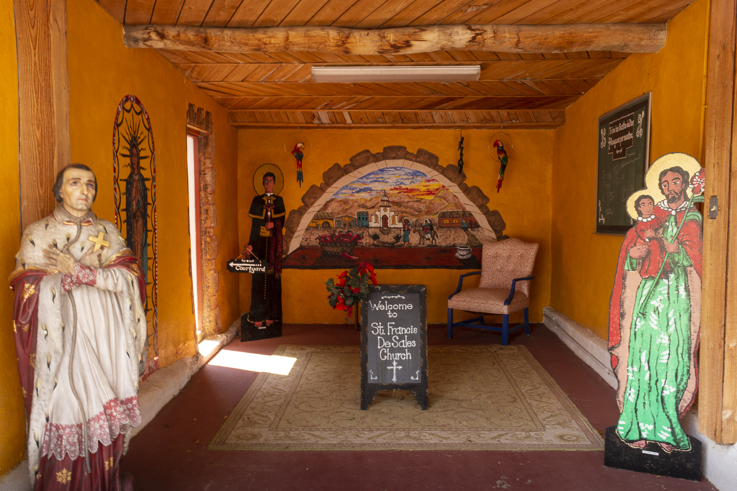
Welcome area/courtyard access adjacent to the chapel.
The church, it turned out, was now a private retreat and event center owned by two sisters. Celeste’s Church, as it is now known, was originally St. Francis de Sales Mission, a Catholic Church for the little community, began in 1860, expanded in 1885, and in service until 1963. Registered with the state as a historic cultural property, it is preserved somewhat in its original state, but it has been enhanced here and there with color and decor. A unique compound graced with palm trees and cacti, I felt for a moment like I was in Green Valley, Arizona, visiting my Aunt Ruth, as I had with my family as a child. It was a nice detour in the day.
With the clock pushing 3 PM and chiles that needed to be peeled at my sister’s that evening, I needed to head for home.
But not before one more side trip…
Cuchillo
My last detour of the day was, naturally, determined by the location of an old church.
Exiting I-25 about 8 miles north of Elephant Butte, state road 181 takes you to 52 west, and 52 west winds over and between low hills that, several miles on, lower you into the remnants of an old farming community.
Cuchillo, originally Cuchillo Negro, was tangentially named after a powerful Apache chieftain whose presence impacted the area.
Several geological features near the community bear his name- Cuchillo Negro Mountains, and the Cuchillo Negro Creek- and they lent their name to the village. Cuchillo Negro, translated from the Spanish as “black knife”, alluded to the darkened, non-conspicuous nature of the blade carried by Apache warriors, and that name was attached to the nearby range that, from a distance, had peaks that appeared like a picket line of dark blades. Occupied by the Mimbres Indians until the 1200, the Apache claimed the valley in the early 1600s, but abandoned it in the mid-1800s. Spanish settlers ranching and farming the area established the town in the 1850s, Cuchillo peaked between 1880 and 1930.
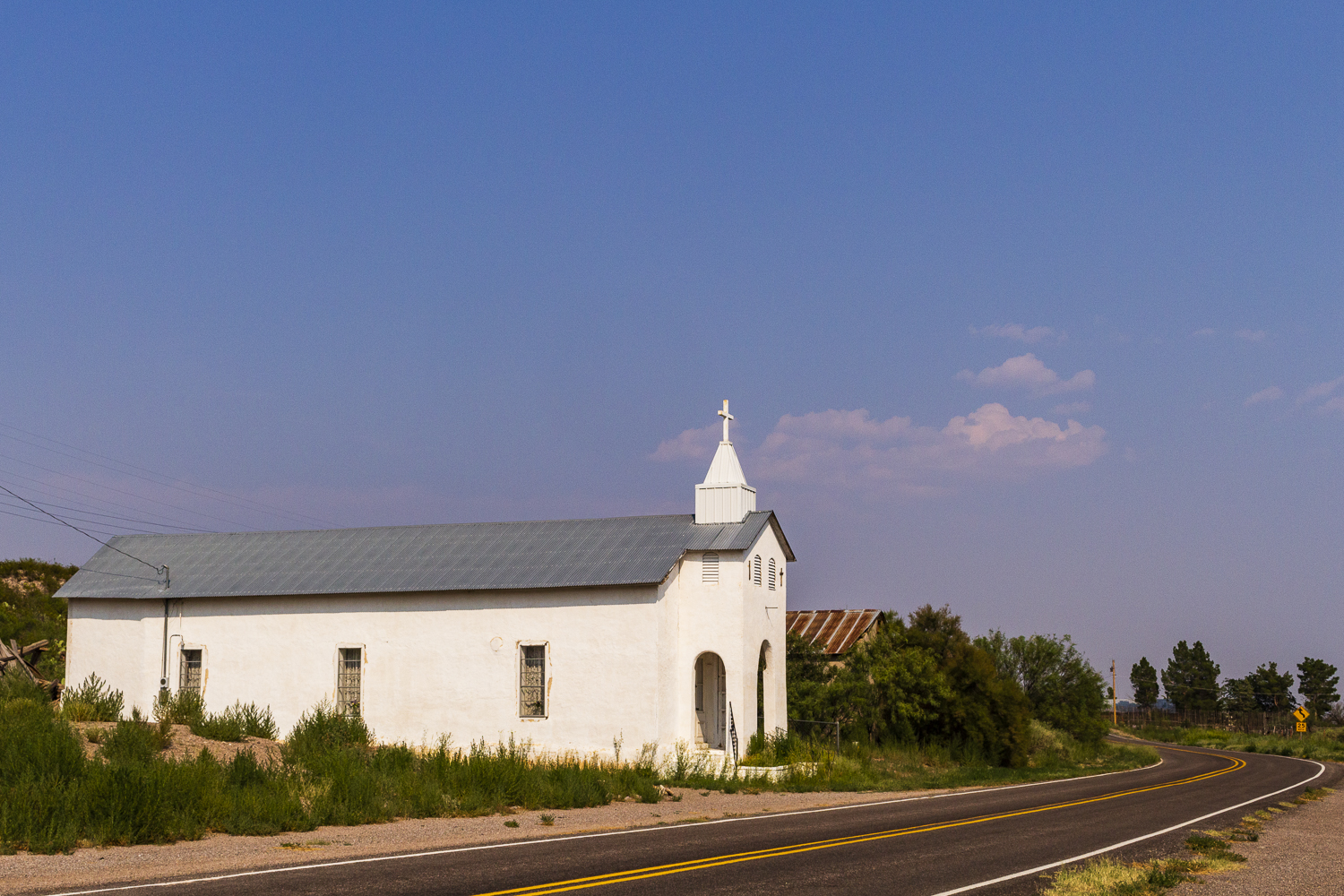
San Jose Church in Cuchillo.
Round the first turn into the ghost town from the east, and a tall white structure stands on the right. Quickly, the building reveals itself as a church. This version of San Jose Church, erected in 1907, is the third version of the building, after the two prior versions were destroyed by flooding.
I stopped for 10 minutes to investigate the structure and to snap a few photos of it. Adjacent to it, recessed in a lot, was a small compound with some God and gun flags waving around some hand-printed placards on posts. I figured 10 minutes was really long enough for my stop at the church.
Curiosity quenched, I made my way back over and through the little hills to I-25, and pushed north towards Socorro, Belen, and my sister’s house in Albuquerque for the chile peeling session to close the day.
2 Responses to Day Trip: Hatch Valley and Old Mesilla