
Anatomy of a Moon Shot
by Bruce • January 15, 2022 • LifeStuff • 0 Comments
I have been slowly working through the book Great Landscape Photography, and in several of the early chapters, author Glenn Randall stresses how he has used imagination and planning to help him take some remarkable photos.
In the last few days, I have been reading a chapter where Randall goes in depth to explain how his shot imagination works. He selects a place he has scouted out before, and then he considers what conditions he would like to photograph the subject in- either with the sun at a certain place in the image, or considering the angle of light a sun on certain days might give to his subject. His scouting has led him to log the location information about the place he is interested in shooting.
His process leads him to later look at his subject, and possible shooting locations of it, in an app called The Photographer’s Ephemeris (TPE), where he can view the sun and the moons’ locations on any given day, and see how their transits might affect his subject. For example, he wonders if he can shoot the glowing orb of a distant sunrise sitting between the legs of an arch. Using his location information and TPE, he can get an idea if his shot is possible as he envisions it from a location.
Randall also suggested using another app, Sun Surveyor, to get a sense of sun and moon positions related to a shooting location and orientation.
As I finished out the chapter on shot planning today, I thought, hey, why not give it- let’s see if I can anticipate a decent shot of today’s rising moon based on his (and my) apps.
I checked an app I use on my phone, Magic Hour, to see when the moon was going to rise today.
3:18 PM.
Now, that given time was for a moonrise at the equator, and with the prominence of the Sandia Mountains to my east, I had to try and come up with a way to figure out when and where the moon would pop up above the mountain range.
I opened and messed around with the TPE app a little bit to kind of get a feel for what the basic version would offer, and then it showed me where the moon was anticipated to rise today based on a vector extending off of a point on a map showing my location.
At around 3:15, I went outside with my camera and walked to a wall across the street where some open space gave me a good line-of-sight to the Sandias, and then I used the vector pointing off of my phone to guess at where the moon would crest the mountain.
I then used another app called SeeLevel to try and get an idea of how may degrees the crest in that direction was above the equator. It took me a few measurements to figure out how I was supposed to use the program, but I finally got a measure of 9.5 degrees above the equator for the target I had set as the moonrise point, which I guessed was in the notch to the left of the Needle, the triangle that sits left of Sandia Crest.
Now I had to figure out how long, based on those degrees, it would take the moon to get up to that notch.
The moon’s transit from horizon to horizon today was going to take 15.25 hours, and since that transit would cover roughly 180 degrees, I calculated that the distance covered each hour in that journey would be about 12 degrees.
9.5 of 12 degrees calculated to be about .8, so I multiplied 60 (minutes) times .8 to get a number of minutes (48) I needed to add to the equator moonrise moment to get an approximate rise time for my moon at that notch: 3:18 + 48 minutes, or at 4:06.
I went inside for a little bit to do some other things, and then I came back out around 3:45 and stood and shivered a bit in the afternoon cold as I watched the mountain and waited for an edge of the moon to appear in my slot.
3:55 came.
And then 4:00.
And then 4:03.
And then 4:04.
And I stared at the slot.
And then 4:06 came.
And I peered through my camera’s viewfinder looking for that sliver…
And then 4:07 came, and the slot was quiet.
So I zoomed the camera lens out a little, wondering if I had entirely missed judging where the moon would rise based on that app vector…
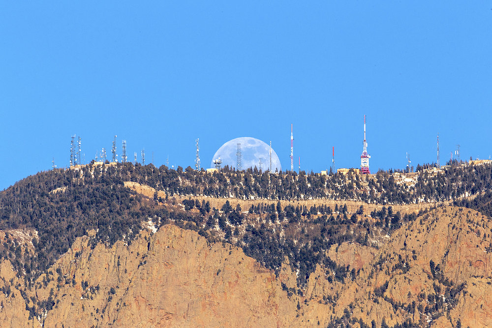
And then, after a moment, a sliver of white appeared behind the top of the Crest.
4:08.
My ballpark direction of rise was off just a little, but it altered the elevation of the mountain at moonrise point by half a degree, and 2 minutes.
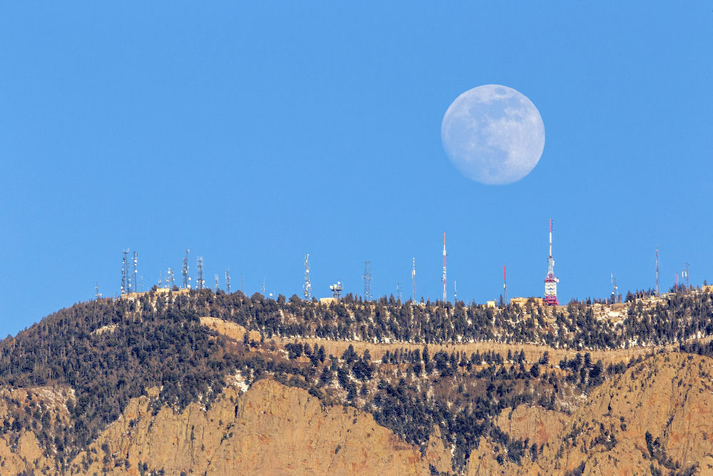
And I took a whole bunch of photos as moon rose and rose and rose.
All in all, the experiment, using apps and math to find the pace and time of the moonrise was rewarding, and turned out pretty on target, and as a result, I was able to take some nice- and fortuitous- shots of the moon springing off of the Crest itself.
‘Twas a good exercise for today, and I can see the application for this exercise in future landscape shoots. Anticipation and planning for effect.
“GOAL!”