Birthday Bolt: Westcliffe, CO
by Bruce • August 12, 2023 • Roadies • 0 Comments
On Friday, August 4th, I was able to take off from work for my birthday, and I used the day to casually drive north to visit my friend Steve up in Westcliffe. The trip would be a lot of driving, but I was up for it. Turning 55 this year, it was a suitable time to drive and look and think and, in a hot Albuquerque August, escape my hometown’s heat.
There was no major agenda for this trip at the outset, except to wander a bit, and hang with Steve for a day on Saturday.
I’ve mentioned Steve here before, but Steve is one of the handful of friends I have had since high school, and over the years, our friendship has deepened, in part because of our affection for baseball, but more significantly, because of our shared faith lives in Christ. We’ve had many a good talks about living a life of faith and meaning in the turbulence of modern culture. We’ve also chatted many hours about MLB teams, players, trades, plays, and games- ‘cuz baseball is fun.
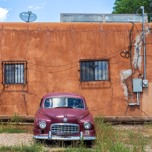
Vegas car.
So I left mid-morning on Friday for Colorado, choosing to go the I-25 route through Raton so I could stop in Las Vegas for lunch at Charlie’s Spic and Span, a restaurant and bakery my folks have enjoyed visiting over the years. I stopped, I ordered a combo enchilada plate, I received a large plate of three different enchiladas, and I put them away in good time. Delicious.
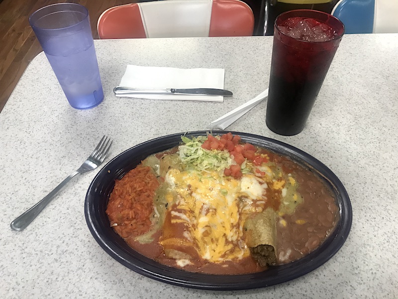
The enchilada combo plate at Charlie’s.
At Charlie’s, you can’t pay for your meal without passing the pastry case by the registers, and so some cookies came with me out the door for consumption in Colorado.
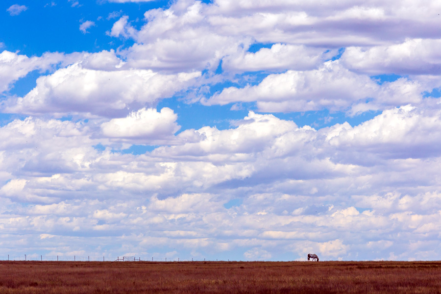
Grazing
After a short drive around old town, I got back on I-25 and started north when I saw a few horses eating under a sky of lingering clouds. Pleased with the scene, I took the next exit and backtracked on a frontage road to the horses and their field, where I had to stop and get a few photos of the moment.
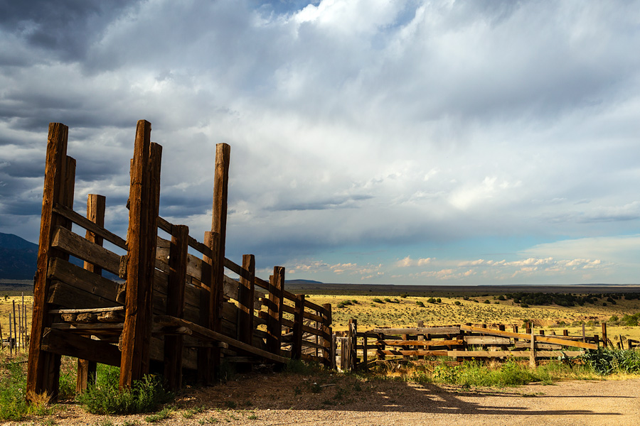
Roadside chute outside of Gardner, Co.
Back on the road again, it was on to Wagon Mound, then by Springer, through Raton, over Raton Pass, and through Trinidad to Walsenburg. From Walsenburg, it was CO-69 north northwest towards the Wet Mountain Valley and Westcliffe.
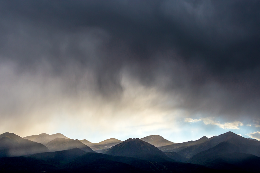
Crepuscular rays on the Sangre de Cristos.
Approaching Westcliffe early evening, clouds hung low over the elevated valley, and when I arrived in town, I went to the park with broad views on the west end of Main Street to watch dark clouds rake over the Sangre de Cristo range and across the valley. There was a strong breeze and sprinkles, and in time, the clouds parted, clearing the way for a rain of sunset light on the valley.
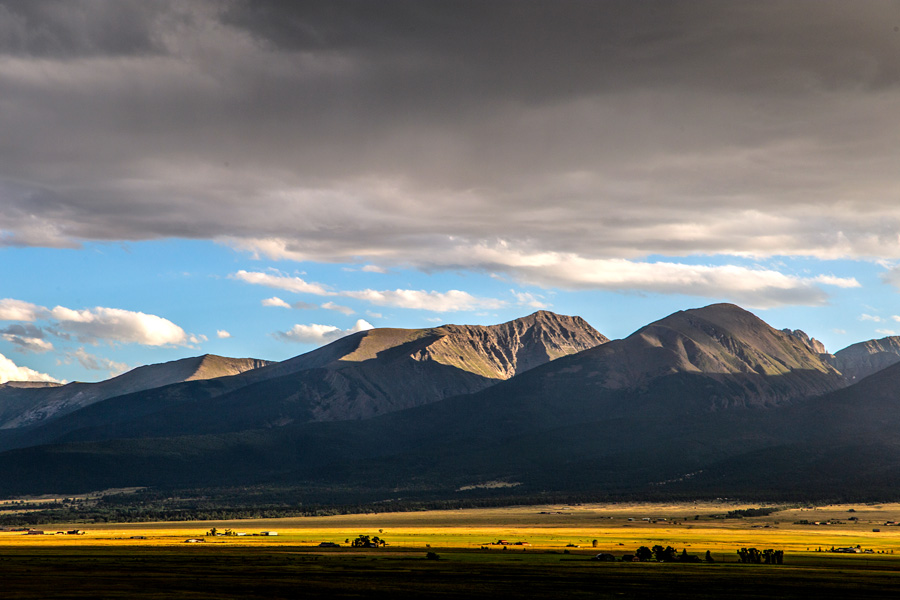
Wet Mountain Valley after the rain.
Steve came in town around dusk, and as I meandered across the valley on the road towards his cabin, stopping for a few photos as the sun dropped behind the mountains, he caught me and we finished the approach together.
After entering the cabin and turning a few things on, we had a bite to eat, chatted, and watched the end of the evening’s Dodgers game before we went to bed.
It was easy to sleep in the cool mountain air.
On Saturday morning we slept in a bit, and then at breakfast, we decided on a plan for the morning, which became a wonderful adventure for the day, and I am glad Steve was up to do it.
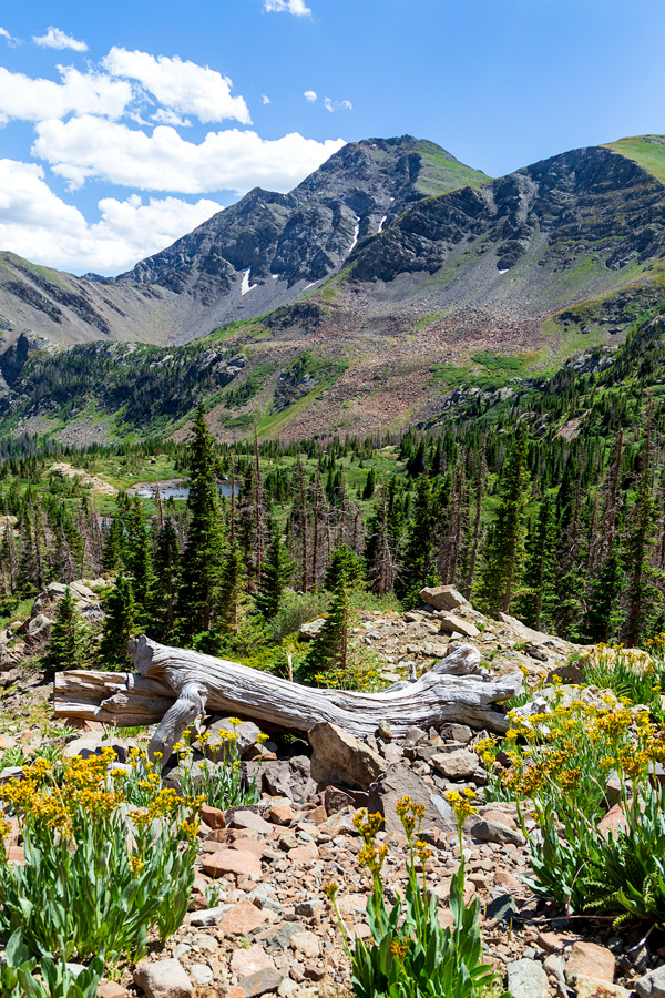
I had mentioned I had been craving some mountain time, perhaps a higher elevation hike to some wild flowers if possible. Steve had a local trail in mind. Unsure if we would be comfortable completing the whole of it, a ride up some of this trail would still be a good adventure, he shared.
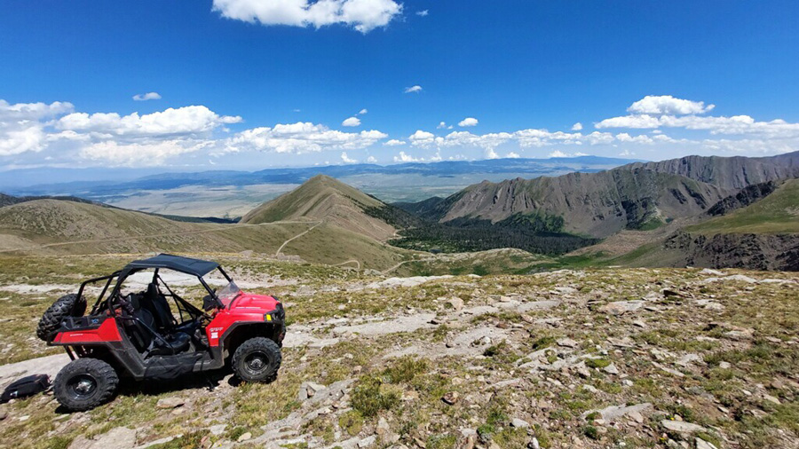
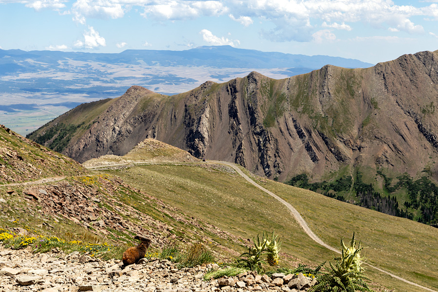
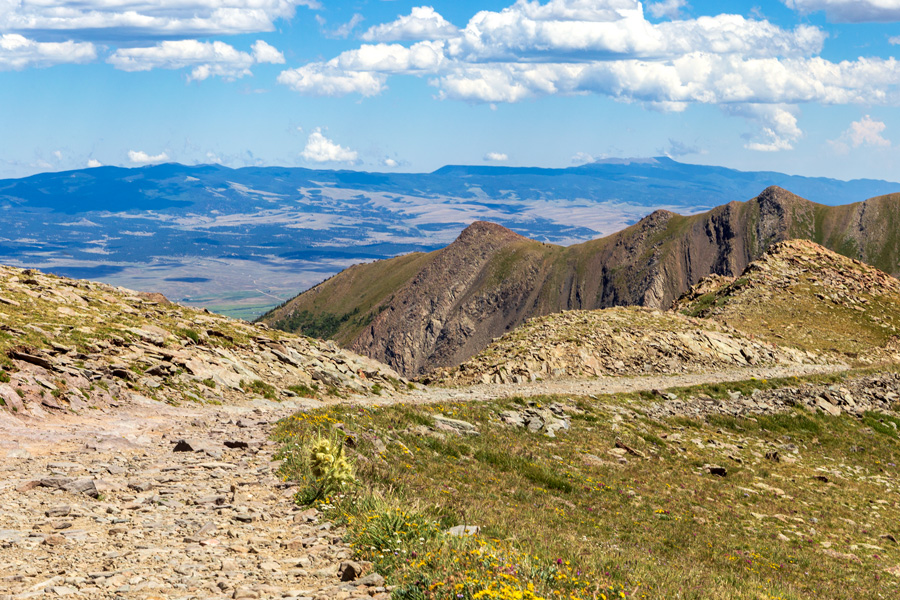
County Road 160, also known as Hermit Road, is a dirt drive that extends west for 5 miles from Westcliffe, and at the mountain base, rises another 9 miles as a trail of riverbed rock that goes up to Hermit Pass, which sits high in the Sangre Range at 13,047 feet. In fact, at that altitude, Hermit Pass is one of the few places in Colorado that off-roaders can drive to that is above 13,000 feet- if they are willing to tolerate the tourturous trail to get there. But at Hermit Pass, you are 4,400 feet above the valley floor below, and can enjoy peering around you at mountain peaks.
Well, Steve has a Polaris RZR that was designed just for such rough rides, and he thought we’d see how far up that trail we’d go. There was a nice stop at Hermit Lake we’d make. And then see where we’d go from there.
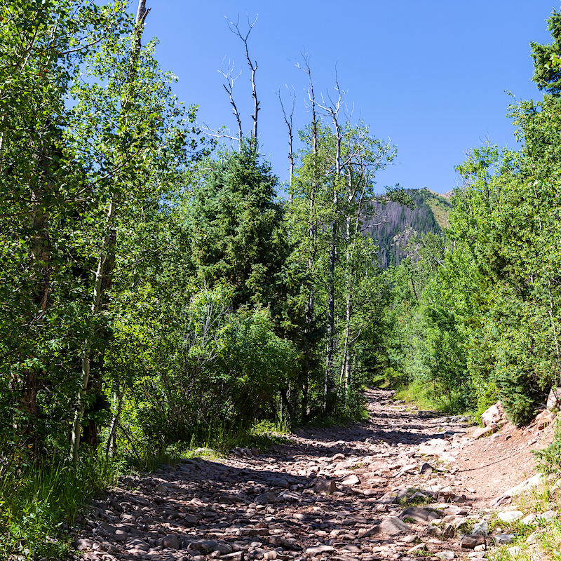
Hermit Road, pretty much the whole way. Bring your mouth guard.
We left the cabin mid-morning in the RZR, headed down the hill from the cabin under clear, sunny blue skies, rolled south around a bend to meet up with CR-160, and then headed back west, into the trees and onto the terrible track, to slowly head up the mountain.
And despite the terrain, it was a wonderful trip.
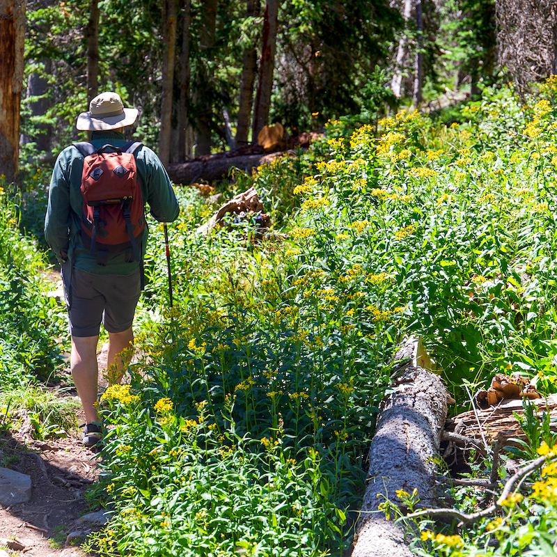
We made a stop at the trailhead to Hermit Lake, sitting 2,000 feet under the pass, and walked through a carpet of colorful flowers as we strolled to and from the lake.
View from the shelf.
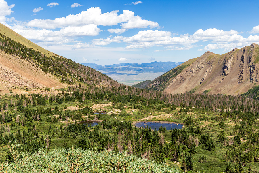
Back in the RZR, we puttered up another 1,000 feet and climbed above the timberline, into the patchy meadows under the talus slopes of mountain tundra, stopping again at a popular vista point on a rock shelf retaining Horseshoe Lake and under the steep eastern face of 13,350-foot Hermit Peak. We walked a bit and admired the peaks and bare rock walls above us. And then Steve said it had been a good day- let’s go on up to the pass.
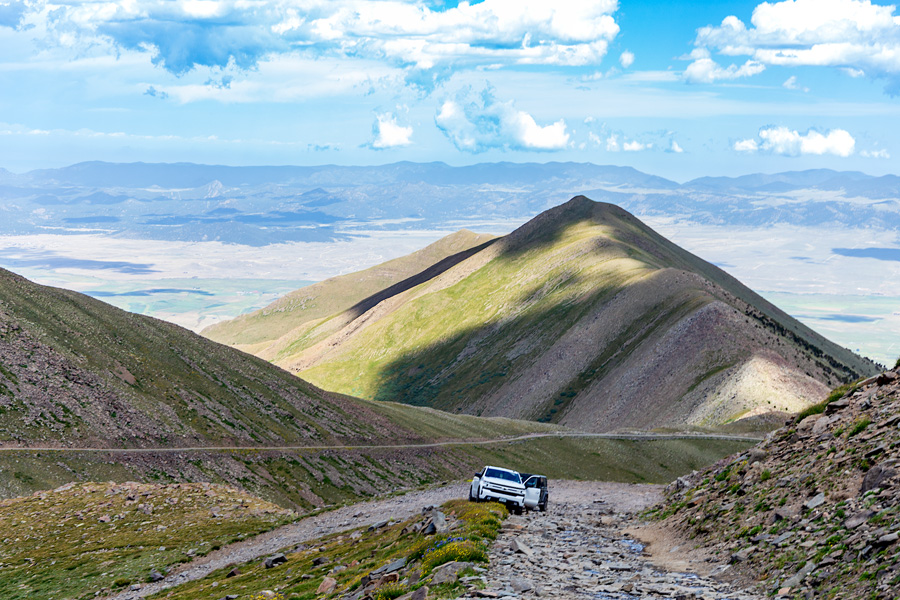
Roadside parking, just downslope from Hermit Pass.
After slowly climbing a straightaway incline and then several zigs and zags towards the clouds, we mounted a flat green plateau. We had arrived at Hermit Pass.
On the pass. Photo credit: Steve Spriggs.
A marmot wonders if we brought anything to eat.
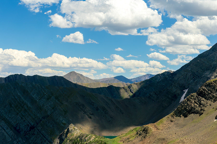
Tundra bowl (and hiding San Isabel Lake) under Hermit Peak (offscreen to the right).
We left the RZR and walked around a bit. We paused to look back at the Wet Mountain Valley and toward Westcliffe. We watched a marmot approach us briefly, check us out, and then leave. We admired Hermit Peak rising to our right, and appraised the line of the trail we had just come up winding down the mountain. We took some photos and enjoyed the moment, and the we returned to the vehicle and settled in for our long drive down the rocky trail.
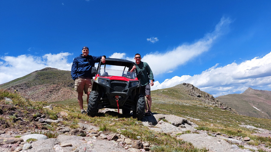
Photo credit: Steve Spriggs’ phone.
Steve was kind enough to drive the duration despite the physical demands on his body, which I appreciated, because I don’t know that I could have handled the vehicle for long very well. Now under the bright afternoon sun, I enjoyed looking around while we descended.
Heading down.
In the end, we- and the RZR- survived the trek, and once back at the cabin, we had a good burger dinner followed by some time resting and watching the Dodgers.
I was cozy enough to hit the sack around 10 PM, while Steve’s son, who was coming up to spend the night with us, was delayed, and Steve stayed up to wait for him.
Sunday morning, Steve and I were up fairly early, and we did a few chores before his son came outside, and we all chatted a bit on the front porch. After breakfast, it was time to break camp, and I was kind of bummed to go- but I had a day of travel ahead, as I had to get back home at least before work the following morning.
But that didn’t mean I wouldn’t wander. And I did wander a bit.
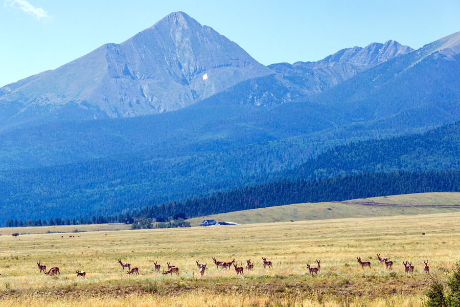
Pronghorns breakfast on the foothill plain.
Heading south out of Westcliffe, I wanted to drive home through Taos, and then head on down NM-68 to Santa Fe, and to do that, I needed to get across the Sangre de Cristos, so Steve directed me to La Veta Pass, and I took several rural dirt roads (County Roads 550, 572, and 29) through the Sangre hills which dumped me onto US-160 about 15 miles east of Fort Garland. At Fort Garland, I could hop on CO-159 south, which would take me through San Luis and then on out of Colorado, past Ute Mountain, and on to Questa.
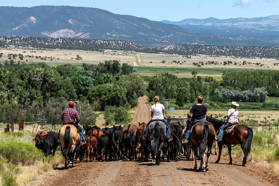
Passed by a cattle drive on a La Veta road.
That was the plan. But because there was a fort in Fort Garland, I had to make a stop.
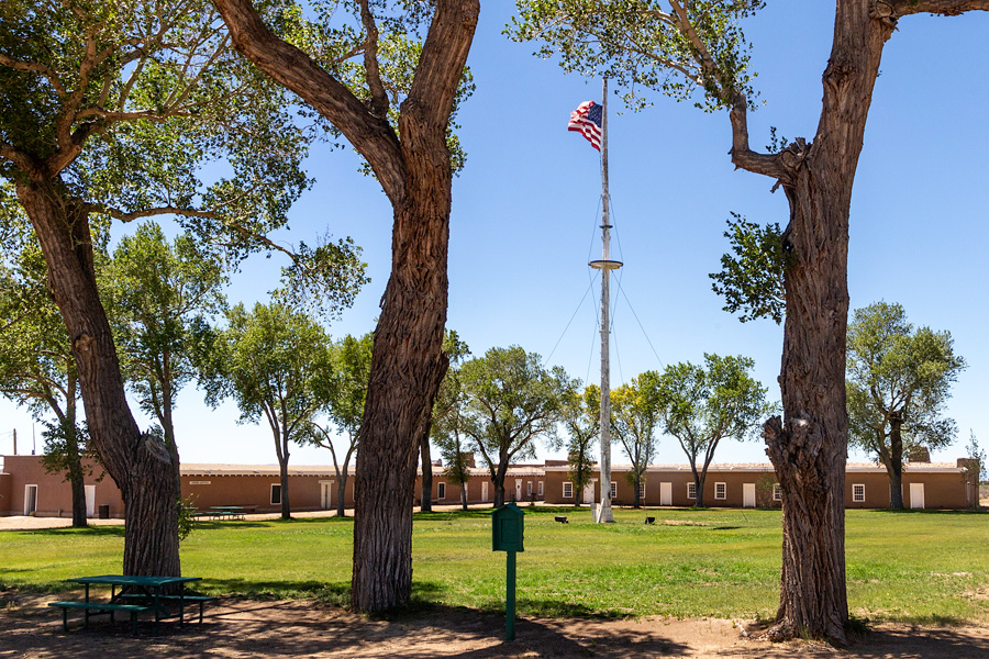
The quad grounds at Fort Garland.
The fort visit was interesting enough.
Fort Garland served for 25 years (1858-1883) as a frontier outpost and was principally charged with keeping peace in the San Luis Valley during the turbulent Civil War and Indian War years. The fort had several notable associations to it during its active days. In 1862, it was the enlistment site for the militia volunteers who went south with Union Major John Chivington into New Mexico to stop the Texas Confederates at Glorieta Pass. In 1866, Kit Carson took command at the fort for a year, striving to broker regional peace with the Ute Indians. From 1866-1869, several companies from the U.S. Army’s Ninth Calvary served there as well- units which were composed of “Buffalo Soldiers”, African American enlistees.
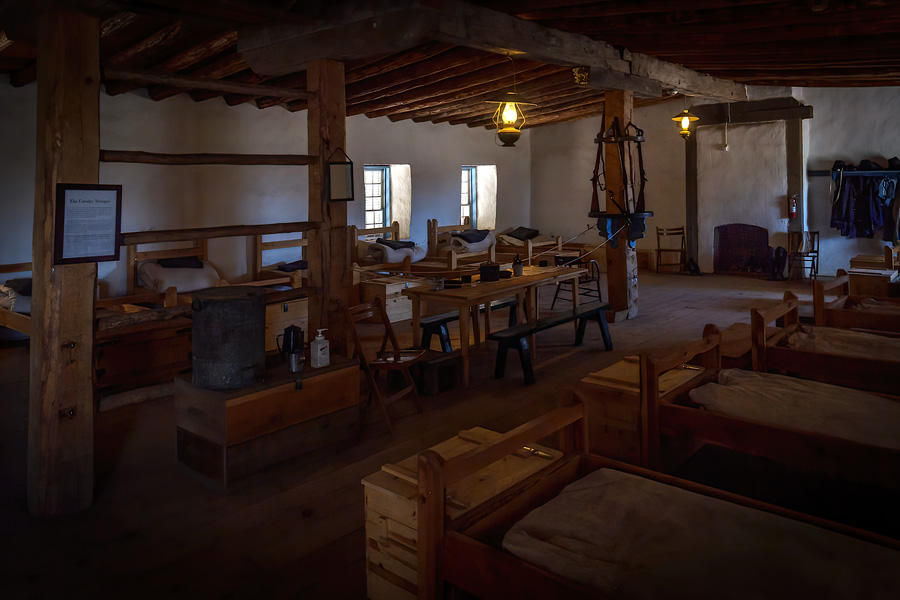
Representation of the calvary quarters at Fort Garland.
The present-day fort has a standing exhibition on the Buffalo Soldiers, and among the represented stories were several pieces that celebrated William Cathay.
Or, Cathay Williams.
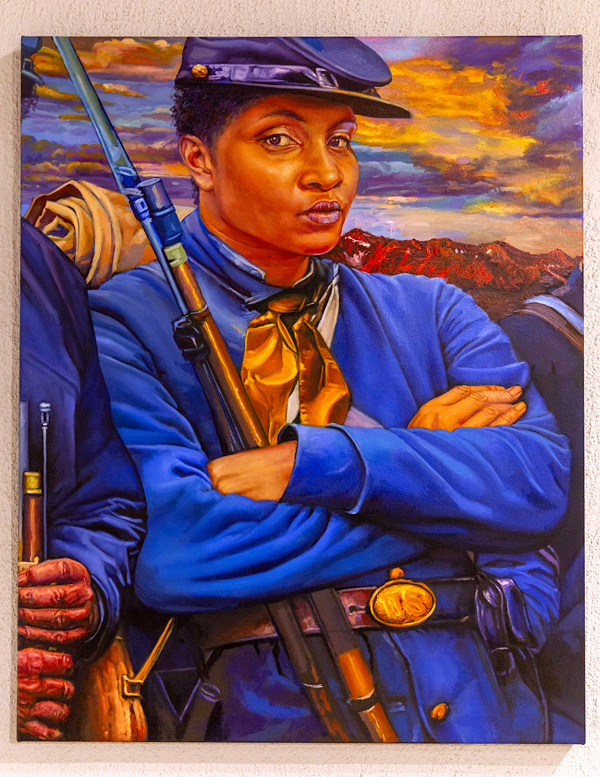
An artist’s representation of Cathay Williams.
As a 17 year-old (and technically a slave by birth), the Missouri native falsified her gender and, in 1866, medical exams being what they were at the time, she was welcomed into the U.S. Army and put into the 38th Infantry Regiment. Her unit was soon sent to the New Mexico Territory, where she served until an illness undid her disguise and led to her (honorable) discharge is 1868. After the Army, she live the rest of her life in New Mexico and Colorado.
After visiting the fort, my intent was just to bullet on home, but heading south towards Questa, NM, I came across a turnoff for the Rio Grande del Norte National Monument in Cerro, NM- a destination I had wondered about for several years since it became a monument in 2013. The sun was still high for the late afternoon- heck, I had some time to check it out.
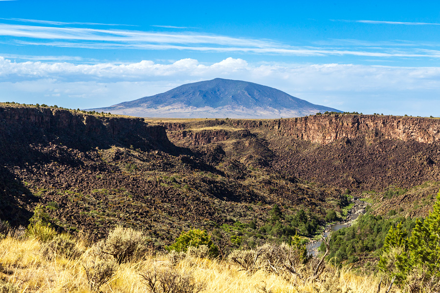
Ute Mountain north of the Rio Grande gorge in the Rio Grande del Norte National Monument.
I drove into park, hitting each of the several pullouts to enjoy views of the northern Rio Grande gorge and, at one viewpoint, the confluence of the Red River (off from Mt. Wheeler) with the Rio Grande. My belief entering the park was that the road would dump me out on south nearer Questa- but I was mistaken. Once I visited the visitor center and picnic and camping sites at the bottom of the park, I realized I had to backtrack to the Cerro entrance to leave it. Oh well. Live and learn.
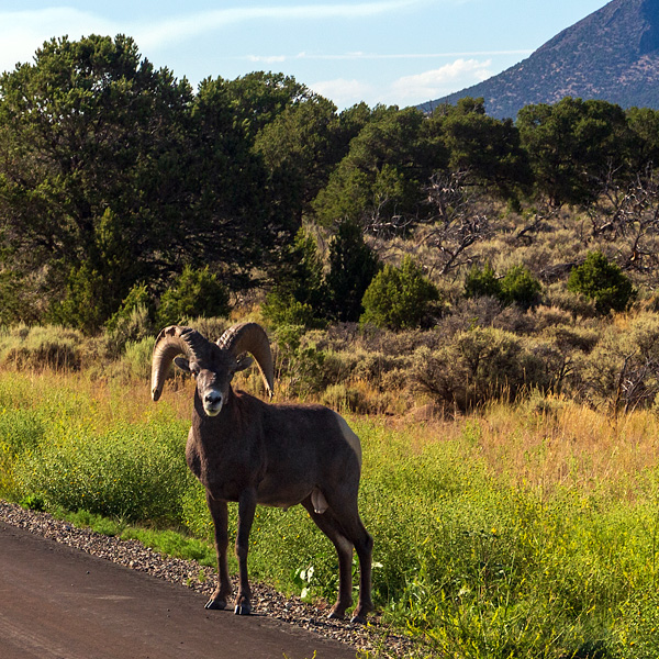
At least I saw this guy.
From Cerro to Questa; from Questa to Taos.
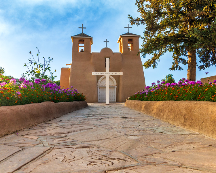
You can’t pass by without stopping at the church.
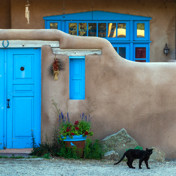
Taos gato.
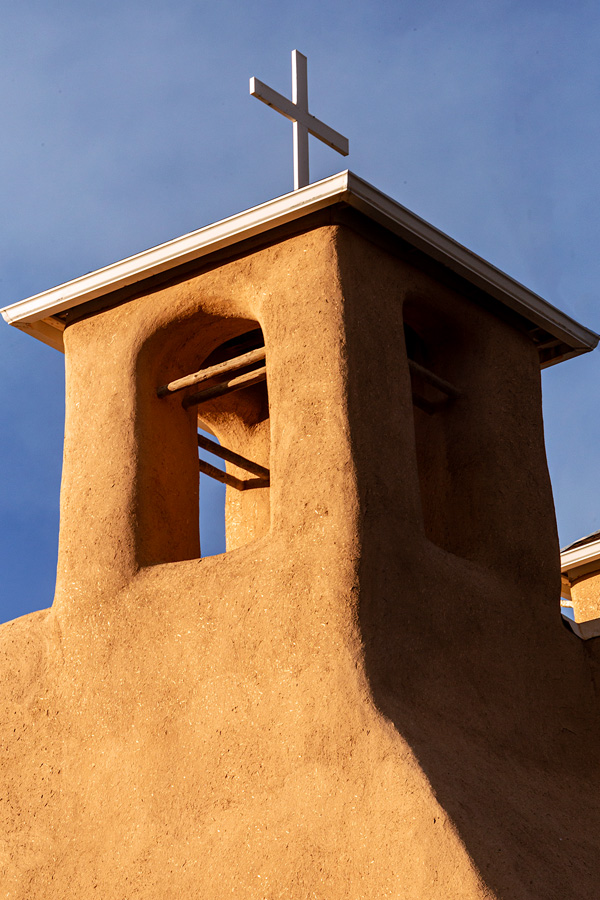
Tower power.
A visit to the church in Ranchos de Taos.
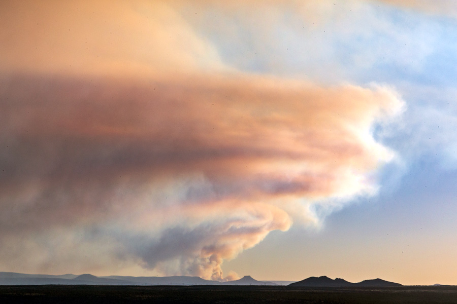
Smoke from the Black Feather Fire burning near Cuba, NM, as seen from south of Taos.
Fueling up under the smoke plume of the Black Feather Fire in Espanola.
The dusk drive into Santa Fe, around Santa Fe on the (seemingly) infinitely-long Santa Fe Relief Route, and the familiar last leg hour drive from Santa Fe home.
All in all, hitting the road and visiting Steve was a most enjoyable way to usher in my 56th year.